Tập tin:Richland-Plummer Creek Covered Bridge, southern side and eastern end.jpg
Kích thước hình xem trước: 800×600 điểm ảnh. Độ phân giải khác: 320×240 điểm ảnh | 640×480 điểm ảnh | 1.024×768 điểm ảnh | 1.280×960 điểm ảnh | 2.560×1.920 điểm ảnh | 2.816×2.112 điểm ảnh.
Tập tin gốc (2.816×2.112 điểm ảnh, kích thước tập tin: 2,77 MB, kiểu MIME: image/jpeg)
| Tập tin này từ Wikimedia Commons. Trang miêu tả nó ở đấy được sao chép dưới đây. Commons là kho lưu trữ tập tin phương tiện có giấy phép tự do. Bạn có thể tham gia. |
|
This is an image of a place or building that is listed on the National Register of Historic Places in the United States of America. Its reference number is 93000466. |
| Vị trí máy chụp hình | | Xem hình này và các hình ảnh lân cận trên: OpenStreetMap |
|---|
| Miêu tả |
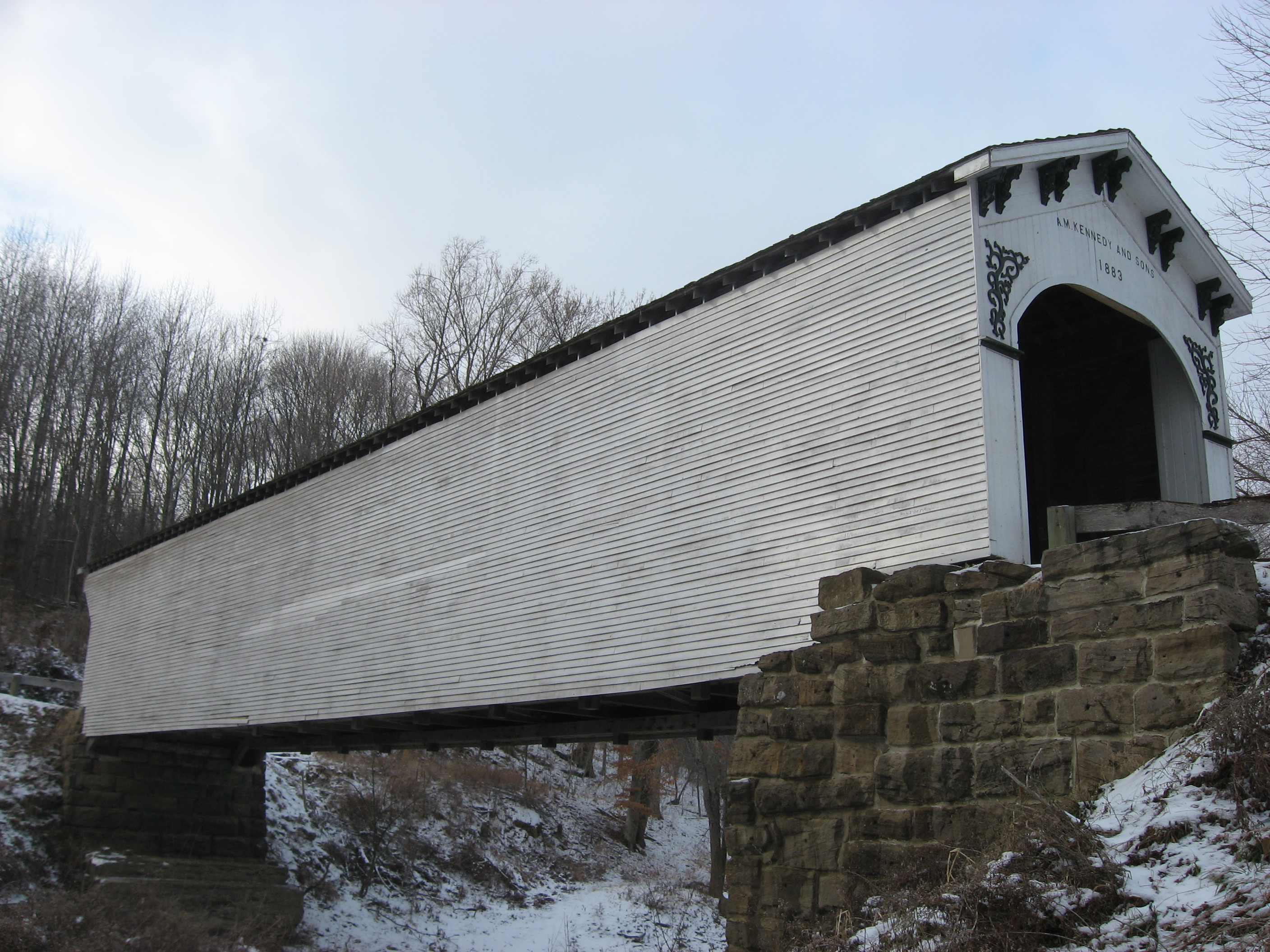
English: Southern side and eastern portal of the Richland-Plummer Creek Covered Bridge, which carries Baseline Road/Road 25E over Plummer Creek south of Bloomfield in Taylor Township, Greene County, Indiana, United States. Built in 1883, it is listed on the National Register of Historic Places. |
||
| Ngày | Taken on 18 tháng 12 năm 2010 | ||
| Nguồn gốc | Tác phẩm được tạo bởi người tải lên | ||
| Tác giả | Nyttend | ||
| Giấy phép (Dùng lại tập tin) |
|
Lịch sử tập tin
Nhấn vào ngày/giờ để xem nội dung tập tin tại thời điểm đó.
| Ngày/giờ | Hình xem trước | Kích cỡ | Thành viên | Miêu tả | |
|---|---|---|---|---|---|
| hiện tại | 13:01, ngày 21 tháng 12 năm 2010 | | 2.816×2.112 (2,77 MB) | Nyttend | {{Location|38|59|34|N|86|56|16|W}} {{Information |Description={{en|Southern side and eastern portal of the {{w|Richland-Plummer Creek Covered Bridge}}, which carries Baseline Road/Road 25E over Plummer Creek south of {{w|Bloomfield, Indiana|Bloomfield}} i |
Trang sử dụng tập tin
Có 1 trang tại Wikipedia tiếng Việt có liên kết đến tập tin (không hiển thị trang ở các dự án khác):
Sử dụng tập tin toàn cục
Những wiki sau đang sử dụng tập tin này:
- Trang sử dụng tại en.wiki.x.io
- Bloomfield, Indiana
- Taylor Township, Greene County, Indiana
- List of bridges on the National Register of Historic Places in Indiana
- List of covered bridges in Indiana
- National Register of Historic Places listings in Greene County, Indiana
- Archibald M. Kennedy and sons
- List of Indiana state historical markers in Greene County
- Richland-Plummer Creek Covered Bridge
- Trang sử dụng tại es.wiki.x.io
- Trang sử dụng tại eu.wiki.x.io
- Trang sử dụng tại ur.wiki.x.io
- Trang sử dụng tại www.wikidata.org
- Trang sử dụng tại zh.wiki.x.io